NCEAS Working Groups
Choosing (and making available) the right environmental layers for modeling how the environment controls the distribution and abundance of organisms
Project Description
Anybody who has ever opened a guidebook to birds or plants is familiar with the range maps showing where a particular species lives. Precise ranges are well known for organisms that are well-studied, such as birds and trees in North America and Europe. . In the tropics and for harder to observe organisms, in contrast, we don't always know exactly where the organisms live. We understand what limits species ranges and what defines range edges for only a small handful of organisms. We do know climate can play a large role in determining range limits, but other factors such as soils and competing organisms also play roles.
Due to the computer revolution in biology, it has now become commonplace to build correlational models that link the range of a species to commonly measured (and easily available) climate variables like mean annual temperature. These models are used extensively to provide predictions about where poorly known species live. They are also increasingly being used to make predictions about where species will live in the future under a rapidly changing climate. Yet there is awareness that these models could be greatly improved if we did some hard thinking (using our biological knowledge) and some hard work (using GIS skills) to develop a state-of-the-art set of environmental indices/metrics that affect organisms.
This working group proposes to develop such a state-of-the-art compilation of environmental factors likely to have a strong impact on species ranges. The goal is to share this compilation with the research community at large, and to use the information to explore what factors are actually the most important and most predictive in determining where a species lives. We will integrate state-of-the-art data and tools including weather station data, satellite remote sensing data and marine buoys in order to create a set of freely available, consistently formatted and scaled environmental data "layers" easily usable in GIS-based analyses. We will also develop a guide book for practitioners documenting best practices. In this way we hope to greatly improve our ability to know where poorly studied species live, and to predict where species will live in the future under climate change.

Principal Investigator(s)
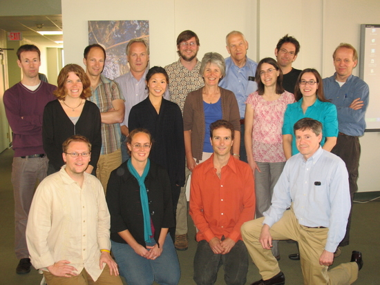
Brian J. McGill, Robert Guralnick, Walter Jetz, Jana McPherson
Project Dates
Start: March 22, 2010
End: January 14, 2014
completed
Participants
- Jennifer K. Balch
- University of California, Santa Barbara
- Julia K. Baum
- University of Victoria
- Lauren B. Buckley
- University of North Carolina, Chapel Hill
- David Conklin
- Oregon State University
- John C. Donoghue
- University of Arizona
- Jane Elith
- University of Melbourne
- Simon Ferrier
- CSIRO Entomology
- Rodney Forster
- Centre for Environment, Fisheries and Aquaculture Science
- John Gallant
- Commonwealth Scientific and Industrial Research Organisation (CSIRO)
- Robert Guralnick
- University of Colorado, Boulder
- Robert J. Hijmans
- University of California, Davis
- Walter Jetz
- Yale University
- John Leathwick
- National Institute of Water and Atmospheric Research
- Tien Ming Lee
- Yale University
- Christy M. McCain
- University of Colorado, Boulder
- Brian J. McGill
- University of Arizona
- Jana McPherson
- Dalhousie University
- Ramakrishna R. Nemani
- NASA Ames Research Center
- Benoit Parmentier
- University of California, Santa Barbara
- Stephanie Pau
- University of California, Santa Barbara
- Steven J. Phillips
- AT&T Labs-Research
- Thiago Fernando L. Rangel
- University of Connecticut
- Sassan S. Saatchi
- California Institute of Technology
- Florencia Sangermano
- Clark University
- Woody Turner
- National Aeronautics and Space Administration (NASA)
Products
-
Journal Article / 2012
Integrating biodiversity distribution knowledge: Toward a global map of life
-
Journal Article / 2014
An assessment of methods and remote-sensing derived covariates for regional predictions of 1 km daily maximum air temperature
-
Journal Article / 2015
Using multi-timescale methods ans satellite-derived land surface temperature for the interpolation of daily maximum air temperature in Oregon
-
Journal Article / 2014
EarthEnv-DEM90: A nearly-global, void-free, multi-scale smoothed, 90m digital elevation model from fused ASTER and SRTM data
-
Report or White Paper / unknown
Botanical geospatial diversity cyberinfrastructure
-
Journal Article / 2014
A global 1-km consensus land-cover product for biodiversity and ecosystem modelling
-
Journal Article / 2015
A global, remote sensing-based characterization of terrestrial habitat heterogeneity for biodiversity and ecosystem modelling
-
Journal Article / 2014
Systematic land cover bias in collection 5 MODIS cloud mask and derived products-A global overview
-
Journal Article / 2016
Remotely sensed high-resolution global cloud dynamics for predicting ecosystem and biodiversity distributions
