Beneath the Frozen Surface: How AI Is Uncovering the Secrets of Permafrost

Beneath the surface of the Arctic, frozen ground holds clues about our planet’s past and its critical information about its future. Known as permafrost, this ground remains below 0°C for at least two years at a time and stores massive amounts of ice, organic carbon, and environmental history accumulated over thousands of years. But understanding how permafrost is changing throughout the Arctic landscape is no small task.
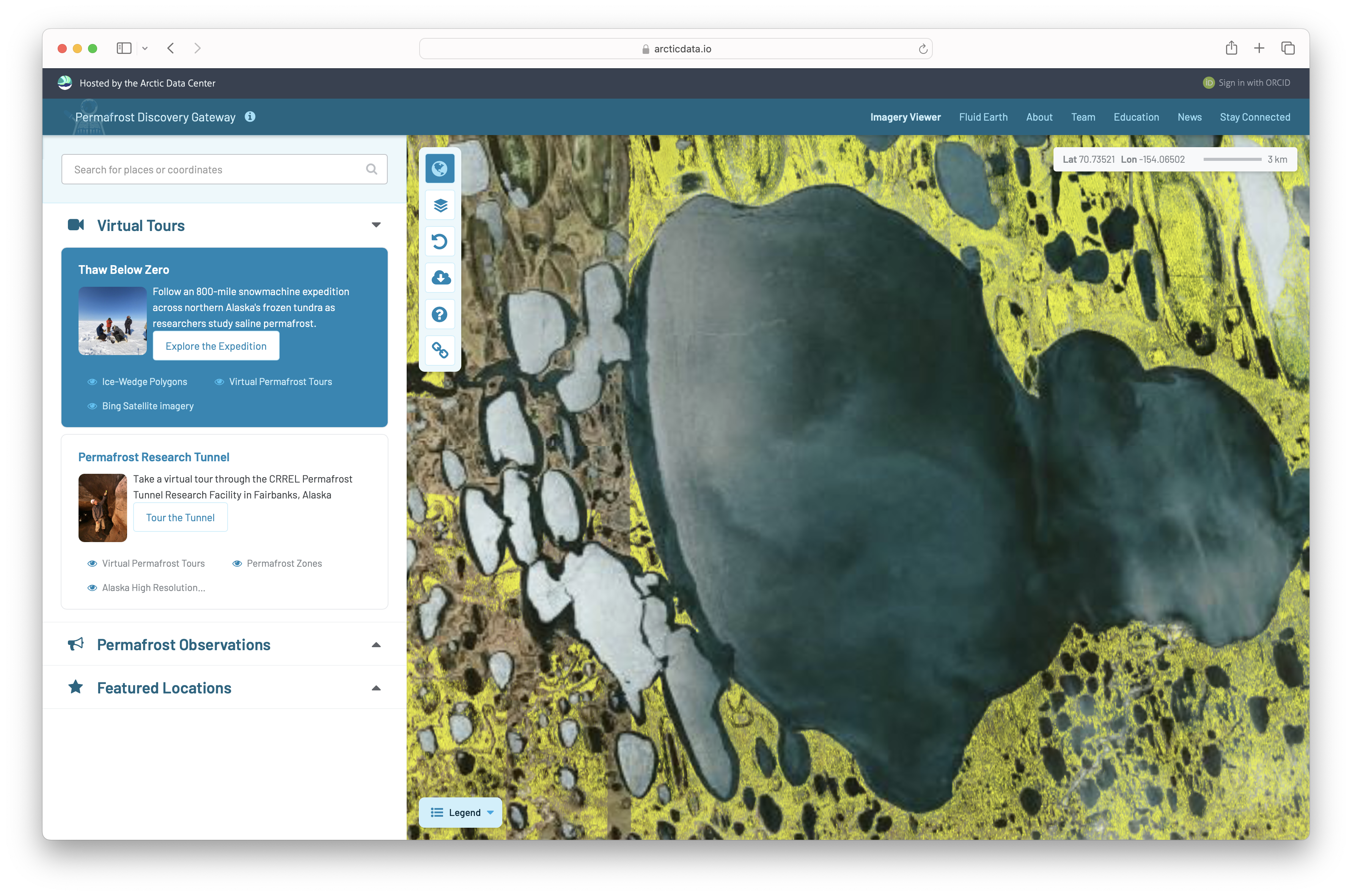
These regions span millions of square kilometers, and the datasets used to study them (from satellite imagery to high-resolution terrain maps) are often too large for most researchers to access or explore. Now, researchers working with the Permafrost Discovery Gateway, a platform hosted by the Arctic Data Center at the National Center for Ecological Analysis and Synthesis (NCEAS), are using artificial intelligence to change that. In collaboration with Google.org, the gateway combines satellite imagery, high-performance computing, and machine learning, opening a new window into Arctic change. One that anyone with an internet browser can explore!
This work is part of NCEAS’s AI for the Planet initiative, which harnesses NCEAS’s 30 years of experience to support responsible, effective use of AI in environmental science. The initiative spotlights how AI can serve as a powerful tool (not a replacement for scientific expertise) in accelerating environmental discovery.
Making Permafrost Datasets Accessible
The Permafrost Discovery Gateway was designed to solve a persistent challenge in environmental science: how to make enormous datasets usable.
As project lead Anna Liljedahl from Woodwell Climate Research Center explains, even scientists with access to high-performance computers can struggle to work with data at this scale, and when their findings are published, they can often only share summaries rather than full datasets behind them:
“The Permafrost Discovery Gateway is a resource, a tool online that the only thing you need is a web browser and internet and then you can get access to scientific products, data that otherwise would be unavailable to you because the data sets are so large.”
The gateway solves this by hosting the data on powerful infrastructure while letting users explore it through an interactive map. Visitors can zoom from an Arctic-wide view all the way down to individual landscape features smaller than a meter. This makes the data not only more accessible, but more transparent. When people zoom into a place they know and see how the data looks in that area, they can better understand both its power and limitations.
Teaching AI to Read the Landscape
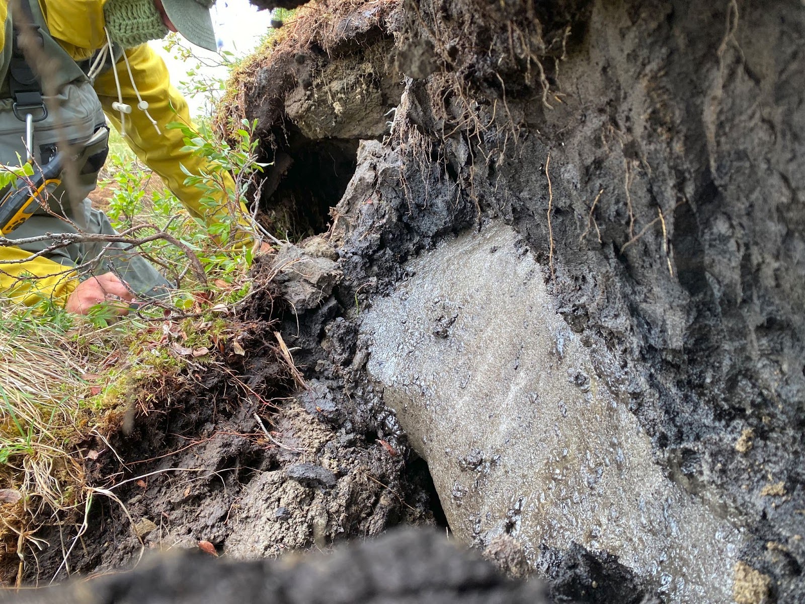
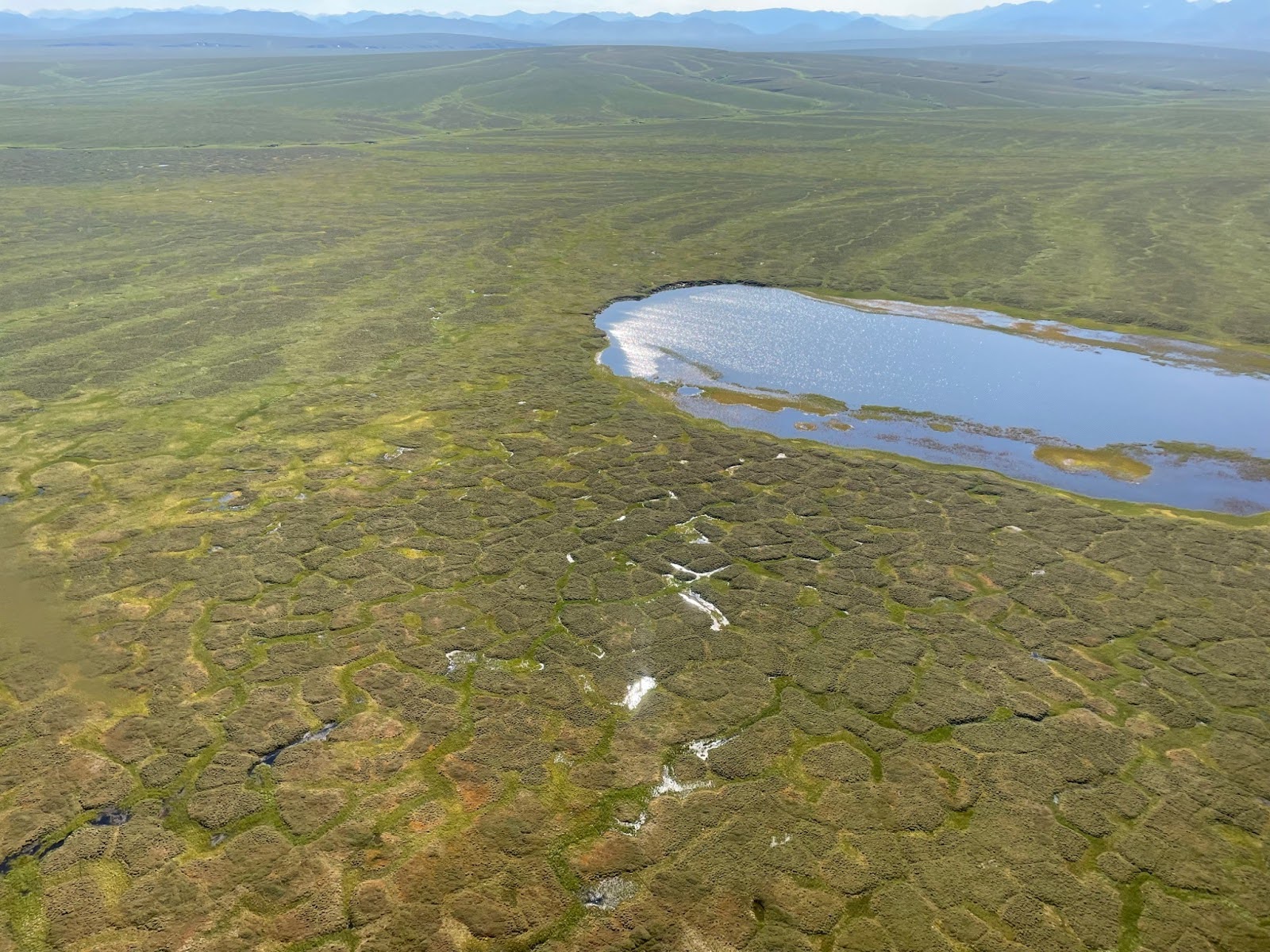
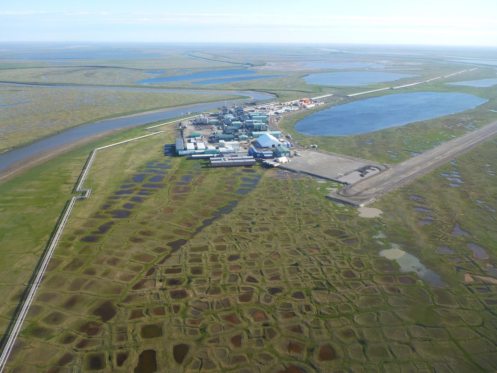
At the heart of the gateway’s analysis is machine learning. Researchers train algorithms to detect distinctive landscape features in satellite imagery, such as ice-wedge polygons: patterns that form when frozen ground cracks during extremely cold winters and fills with ice over thousands of years. These features reveal where permafrost contains large amounts of ground ice and where landscapes may be vulnerable to sinkholes.
Liljedahl describes the approach:
“The AI that’s been used is feature detection. It’s machine learning and deep learning models that are trained to detect certain features in imagery.”
Researchers have already used them to map ice-wedge polygons, troughs formed by degrading permafrost, lakes and drained lakes, landslides, and even infrastructure such as buildings in Arctic regions. This can help estimate how much development could be at risk as the ground beneath it changes due to thawing of ice-rich permafrost. The tundra is particularly well-suited to this kind of remote sensing: with no tree cover to obstruct the view, satellite imagery can capture surface features in remarkable detail. Once trained, these algorithms can scan enormous areas of satellite imagery far faster than any human analyst.
Helping Us See Patterns
One of the biggest advantages of AI is its ability to analyze patterns across massive datasets which allows scientists to move beyond scattered field observations and understand change at a larger scale, such as the entire Arctic.
One surprising discovery came from mapping troughs: depressions formed when ice wedges degrade and the ground subsides. Analyzing these features across broad landscapes revealed far more evidence of permafrost change than scientists previously realized, helping answer one of the field’s biggest questions: whether permafrost thaw is widespread across the Arctic or limited to specific locations.
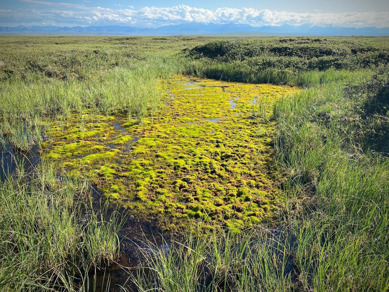
AI is also helping scientists look at the other side of that story. While much of the focus in permafrost science is on thaw, there are also processes through which permafrost can reform. Moss, for example, plays a surprisingly important role: acting as an insulating blanket, it reduces heat reaching the ground in summer and shades water surfaces, helping maintain cooler ground temperatures and supporting permafrost recovery in some areas.
By combining satellite data, machine learning, and field observations, researchers can begin to piece together a more complete picture of how frozen landscapes are changing in both directions.
Why Permafrost Matters Beyond the Arctic
Although permafrost may seem remote, its impacts extend far beyond the Arctic. In Alaska alone, roughly 80 percent of the land contains permafrost to some degree, and more than 140 communities build on it. Many of these communities are extremely remote and depend on air travel for essential supplies. When ice-rich ground thaws beneath roads, airports, pipelines, and buildings, the damage can be swift and severe.
“As soon as you build a road on permafrost or a runway for an airport, you’re disturbing the soil,” Liljedahl explains. “If you put more heat into the ground, you’re going to get sinkholes.”
The stakes extend to national security as well, with many military installations across the Arctic depending on stable infrastructure in a region that is warming faster than almost anywhere else on Earth.
Permafrost also plays a critical role in the global climate system. Frozen soils store enormous amounts of carbon accumulated over millennia. When thawed, microbes break down this organic material and release carbon dioxide and methane, the greenhouse gases that accelerate global warming. Understanding where permafrost is thawing and where it may remain stable is therefore essential for local communities, defense planners, and global climate science alike.
Making Science Accessible to Everyone
Beyond scientific discovery, one of the gateway’s most important goals is accessibility. The platform is designed not just for researchers, but also for educators, students, land managers, and Arctic residents. Anyone with curiosity and an internet connection has access! Local residents, in particular, bring irreplaceable knowledge of the landscape. Making data accessible helps connect local expertise with the scientific record.
“If you make data accessible to everyone with an internet browser, there’s going to be all these cool questions and ideas that the data is exposed to,” Liljedahl says.
The team has also developed K–12 education materials aligned with national science standards so teachers can incorporate Arctic data into their classrooms to teach climate science, data analysis, and AI.
This aligns with a core principle of the AI for the Planet initiative: responsible AI use means making science more open, transparent, and more useful to a broader community (not just those with the computing resources to handle it).
The Future of AI in Arctic Science
While machine learning is already transforming how scientists analyze satellite imagery, Liljedahl sees even greater potential ahead. She imagines a future where researchers and curious members of the public can simply ask questions about the data and receive answers almost like a search engine for Arctic science (with no complicated software, specialized hardware, or data analysis background required).
Such tools could dramatically lower the barriers to exploring environmental data.
“You don’t need to have a humongous computer yourself. All you need is to have a question or be curious about something and ask the AI assistant to explore.”
In this vision, artificial intelligence does the heavy lifting of analyzing enormous datasets, while humans bring creativity, context, and new questions. Together, they could unlock new insights that neither could discover alone.
The Permafrost Discovery Gateway is currently supported in part by Google.org, but that funding is coming to an end. If you're interested in supporting the gateway's future through the LEO Network, which allows Arctic community members to submit observations and stories about environmental change, or through direct partnership, the team welcomes your involvement.