Quantification of uncertainty in spatial data for ecological applications
Project Description
Land cover maps are a primary data source for persons designing reserves, working on management plans for sensitive species, and performing ecological risk assessments. Maps are generalizations of reality and contain spatial uncertainty from the generalization which should be quantified for ecological applications. We propose to develop a spatial statistical approach that can deal comprehensively with the problem of error propagation and provide a bridge between the distinct traditions of remote sensing and Geographic Information Systems. One or more case studies illustrating the approach would be undertaken by an interdisciplinary team, and a specialists meeting would provide input during the first year of work.

Position Statement by Ashton Shortridge
Principal Investigator(s)
Project Dates
Start: September 22, 1996
End: July 8, 1999
completed
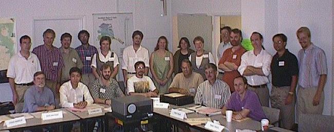
Participants
- Kate Beard
- University of Maine
- Barbara P. Buttenfield
- University of Colorado
- Ted Case
- University of California, San Diego
- Ferko Csillag
- University of Toronto
- Frank W. Davis
- University of California, Santa Barbara
- Ronald Eastman
- Clark University
- Geoffrey Edwards
- Laval University
- Charles T. Ehlschlaeger
- City University of New York (CUNY), Hunter College
- Peter F. Fisher
- University of Leicester
- Marie-Josée Fortin
- Université de Montréal
- Steve Franklin
- University of Calgary
- Mark A. Friedl
- Boston University
- Michael F. Goodchild
- University of California, Santa Barbara
- Carolyn T. Hunsaker
- USDA Forest Service
- Phaedon Kyriakidis
- Stanford University
- Kenneth McGwire
- Desert Research Institute
- Kevin S. McKelvey
- Forestry Sciences Laboratory
- Ashton Shortridge
- University of California, Santa Barbara
- Fred H. Sklar
- South Florida Management District
- Peter A. Stine
- US Geological Survey (USGS)
- Jay M. Ver Hoef
- Alaska Department of Fish and Game
- A-Xing Zhu
- University of Wisconsin
Products
-
Book Chapter / 2001
Measuring and predicting species presence: Coastal sage scrub case study
-
Book Chapter / 2001
Introduction
-
Book / 2001
Spatial uncertainty in ecology
-
Presentations / 1999
Regional uncertainty in global accuracy statistics
-
Presentations / 1999
Uncertainty of spatial data for landscape models
-
Book Chapter / 2001
The use and uncertainty of spatial data for landscape models: An overview with examples from the Florida Everglades
-
Book Chapter / 2001
Uncertainty and spatial linear models for ecological data
-
Book Chapter / 2001
Uncertainty in spatial data for ecological analysis
