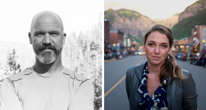
NCEAS Portraits: Will McClintock and Grace Goldberg Enable Smart Decisions about Managing Oceans

Smart decisions about natural resource management typically include two things: collaboration between diverse perspectives and data from various scientific sources. These are the bread and butter of NCEAS, as well as of two scientists we recently welcomed to our community: Will McClintock and Grace Goldberg.
In August McClintock and Goldberg migrated from the UCSB’s Marine Science Institute (MSI) to NCEAS to join us as a Senior Fellow and a Specialist, respectively. While maintaining their MSI affiliations, as formal members of the NCEAS community they will be able to enhance and amplify their work in the development and implementation of innovative software that facilitates collaborative, data-driven decision-making for managing oceans sustainably.
McClintock and Goldberg focus on making science-based decision-making software accessible and useable to more people than just the technical experts who develop them. For example, both have been instrumental in the success of SeaSketch, a decision support tool for marine spatial planning developed by members of the McClintock lab, including Chad Burt, Todd Bryan, and Dan Yocum.
Such tools enable and empower participation from the many groups with a stake in natural resource management – from the scientists, to the managers, to the resource users. Decisions that come from a more inclusive and collaborative process like this are better positioned to meet the needs of the affected ecosystems and communities.
McClintock and Goldberg took time to share what joining the NCEAS community means to them.
Why are you excited about being part of the NCEAS community?
WM and GG: Our work is focused on supporting stakeholders with diverse backgrounds in the process of collaborative, science-based decision-making. This work itself is also collaborative, and several of our projects over the years have involved NCEAS researchers. We’re excited to be working close to those in the NCEAS community who are bridging the gap between the public, resource managers, and scientists, particularly when technology is involved in mobilizing science to action.
What projects are you working on, and especially those that are related to NCEAS’ mission?
WM and GG: We develop tools to bridge novel science with the people that can use it to enhance nature conservation and sustainability goals. Last year we began supporting members of a SNAPP working group in translating some of the products they had developed to inform sustainable fisheries management into a web-based tool called FishPath, which has allowed them to scale implementation of those materials with fisheries managers around the globe.
Another exciting synergy is the implementation of the Cumulative Impact modelling framework, developed by NCEAS Director Ben Halpern within the SeaSketch platform, which allows users to explore how a range of pressures contribute to ocean health and will aid the development of management plans to minimize human impacts. Over the past few months we’ve been working with the Swedish Agency for Marine and Water Management to customize a web tool that mobilizes the models in an iterative planning process. Marrying the analyses with easy-to-use spatial design tools allows the Agency staff and their stakeholders to express ideas in a creative process informed by complex synthesis science.
We’re looking forward to building new projects around storing and analyzing ecological monitoring data, and connecting non-technical audiences with science so they can make data-informed decisions and better understand natural phenomena.
What is the value of collaborative, open science to your work?
WM and GG: Making scientific information accessible to those who need to use it requires partnering with scientists excited about exposing their data and working transparently and collaboratively. In the SeaSketch project, for example, each group using the tool populates marine planning maps with relevant data, makes decisions about how those data should be analyzed in decision-making, and collaborates in online forums that link discussions to the map. This unique map-based collaboration software supports groups of scientists coordinating with resource managers, often exposing planning tools to the general public. For instance, members of the Interagency Working Group on Ocean and Coastal Mapping (IWG-OCM), U.S. Geological Survey's 3D Elevation Program, and NOAA’s Office of Ocean Exploration and Research are working together in SeaSketch to coordinate the mapping and research activities of Federal and state agencies around the United States.
Our other software projects have an emphasis on empowering data contributors and users to share information transparently. For example, the eCatch iOS app we developed in partnership with The Nature Conservancy California Fisheries Program allows for data sharing between fishermen, scientists, and managers in a California fishery to help them reduce bycatch collaboratively.
How will being part of the NCEAS community enhance your work?
WM and GG: Working with scientific experts who are excited about connecting their work to real-world applications is critical to building effective tools. We see the NCEAS community as a hub of just these people - scientists engaged with practitioners tackling sustainability challenges for the oceans and more broadly. We’re keen to learn from the community and imagine new opportunities in which accessible web-based technologies can help connect science to better decisions for the planet.
###
NCEAS Portraits feature the people behind our work and impact.
