New Partnership between NCEAS and Microsoft Could Help Streamline Ecosystem Assessments Using Artificial Intelligence
Two major challenges of conducting ecosystem assessments – the health report cards scientists and managers use to set goals and track progress for restoring oceans, forests, and other places people care about – are that they often take a long time and they can be hard to reproduce. As a result, it can be tricky to track if restoration efforts are working.
But what if scientists could harness the speed of machine learning, the power of big data, and the accessibility of cloud computing to streamline the process? That is what a new partnership between NCEAS and Microsoft is setting out to do.
Under the auspices of Microsoft’s AI for Earth initiative, the partnership is investigating the potential of applying artificial intelligence to ecosystem assessments. The goal is to identify opportunities that can help accelerate progress on ambitious goals for planetary health, such as the United States’ 30 by 30 initiative to protect 30 percent of its lands and oceans by 2030 and the United Nations’ Decade on Ecosystem Restoration, its call to restore the world’s ecosystems to reach Sustainable Development Goals by 2030.
“There is so much data, but there is a need to translate it to know if it’s saying an ecosystem might be in peril or is recovering. And there's the need to do that in a way that doesn't take four years to figure out,” said project member Carmen Galaz-Garcia, a data scientist at NCEAS.
Computing tools such as machine learning algorithms have the potential to not just quicken the pace of conducting assessments – shrinking those four years down to a year or even a month, for example – but also make it easier to repeat them year after year to get a more continuous report on how ecosystems are faring.
The partnership combines NCEAS’ expertise in environmental synthesis and data science and its capacity to convene diverse experts with Microsoft’s computing power and expertise.
The project team will use Microsoft’s Planetary Computer, a Python-based computing environment that can store a huge amount of data and, as an “integrated” system, can process and package those data in a consistent, ready-to-use way and with enough computing power to analyze them. It also allows users to store their data and code in the cloud, rather than on a local computer, saving them from the time-consuming process of downloading data. (For the geoscientists reading this, it leverages the Pangeo software ecosystem.)
The two main components of the project will be to identify the opportunities for using artificial intelligence and large data streams to automate and streamline ecosystem assessments and to conduct a proof-of-concept case study. Last month, the project team convened experts from the computing and environmental science disciplines for a workshop to identify those opportunities – stay tuned for their forthcoming publication – and the team is currently deliberating its focus for the case study.
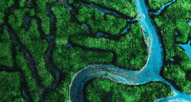
Through the case study, the team aims to apply the power of synthesis science to help close a critical gap in ecosystem assessments that is as old as ecology itself: the divide between observational scales and, specifically here, between the course view of satellite data and the details of ground observations.
“A lot of the ecosystem assessments are using either only ground data or only remote sensing satellite data. So, in one sense, integrating the ground data will allow you to ground truth your remote sensing,” said Galaz-Garcia. “But also integrating these different scales – they call it mud to space – we think could give a more well-rounded view of ecosystem health.”
Satellite data are good for understanding large expanses of land and how they look from above, while ground observations can give the details of, say, whether trees are sick with disease. The ability to link how the forest looks from above and what is going on with the trees below – or use algorithms to fill holes where ground data aren’t sufficient or available – could give a more complete picture of ecosystem health and improve how managers both target places in most need of restoration and track how recovery is going.
“To me, that's exciting,” said Julien Brun, another project member and senior data scientist at NCEAS. “Even if we move the needle a little bit, that might make a change in how people manage land or make decisions. Because we won't be able to collect all the data we wish we had from the ground.”
Open science and open dialogue are also at the center of the partnership.
“We plan to share our code, workflows and any data products that might come out of this project,” said Galaz-Garcia. “Because we really want it to be reproducible, so not only can we reproduce the assessment multiple times, but other people can reproduce it and maybe adapt it to their situation.”
Moreover, because the Planetary Computer is still evolving, Brun says the partnership presents a unique opportunity for feedback between NCEAS and Microsoft that could pinpoint how the computing environment could be most helpful to ecosystem assessments.
“We have a partnership where they want to hear from us – where are the sticky points for ecosystem assessments, and how can they help to remove them,” said Brun.
With a relatively quick project turnaround of sixteen months, it won’t be too long before they can share what they learn with the ecosystem assessment community. Stay tuned!